Research Report: Google Earth
Abstract:
"Google Earth" is a software program that allows users to navigate through a collection of satellite images of the planet Earth using a customizable, globe-based interface. The images are provided by a variety of organizations including NASA. The software allows its users to search for and view specific locations around the world by inputting addresses, latitude and longitude coordinates, landmarks, etc. The program also allows users to mark points of interest and create travel routes.
Description:
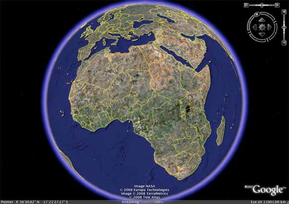
Completed by Google Inc. in 2005, "Google Earth" is a software program that offers users a virtual model of the Earth's surface. The program uses a variety of aerial photographs, satellite images, and existing topographical data to construct an interactive representation of the Earth.
The program allows users to click various navigation buttons to rotate the globe or zoom in on specific locations. By inputting the name of a city, state, country, or continent, users can view a more detailed portion of the globe. In addition to these parameters, it is also possible to search for locations using latitude and longitude coordinates.
In addition to the basic search feature, "Google Earth" also contains all of the directions and route-planning tools found on its sister site, "Google Maps." Users can either input "To" and "From" locations in the directions search bar or navigate to the "Start" point on the globe, right click the location, and select "Get directions from here." Once the "Start" and "Destination" locations have been input, the program draws up a route, providing step by step directions as well as offering users a visual representation of the route in the "Google Earth" browser window, as seen below:

The program is available in three versions that can be downloaded from its website. The basic version is free to the public and intended for personal use. The two premium versions, available for a fee, contain the same satellite images but include an additional set of tools that give commercial users the ability to create video and audio files using self-imported geographical data. All three versions contain three-dimensional overlays that can be turned on and off in the preferences menu or the browser's sidebar. These 3D overlays range from buildings and cultural landmarks to geographical features like the Matterhorn in Switzerland:

Apart from the three-dimensional objects created by Google Inc., "Google Earth" is compatible with other programs that allow users to create their own 3D objects, ultimately allowing them to be placed within the "Google Earth" landscape. In terms of further customization capabilities, "Google Earth" allows users to add "Placemarks" to specific locations; these locations are saved in the sidebar under the "My Places" tab and can later be recalled with a single mouse-click. Routes and driving directions can also be saved for later access. Further, Google's partnerships with companies and organizations like Wikipedia allow users to find out more information about a specific location within the "Google Earth" interface. This integration allows users to create new entries for specific locations. Information included in such entries ranges from population data and descriptions of climate to photographs of local points of interest.
The program's website contains a library of downloadable "KML" files, described as "interactive files containing highly visual, location-specific information" (Google Inc., http://www.earth.google.com). These files contain user-compiled collections of place markers, paths, informative posts, photographs, etc., describing a wide variety of socio-historical topics. For example, a KML file containing WWII era political boundaries may be downloaded and placed on top of existing boundaries for comparison.
"Google Earth" has recently integrated a view of the solar system into its browser, making it possible for users to view the position of the various planets and constellations. This portion of "Google Earth," referred to as "Google Sky," can be accessed by clicking a button in the browser's toolbar.
Commentary:
"Google Earth" is particularly relevant to this project because it allows for the production of a simplified, visual model of a literary text that is at times overwhelmingly mobile. This software program presents the opportunity to take a text that devotes page after page to descriptions of travels, journeys, migrations, etc., and transform it into a more accessible, non-literary representation. "Google Earth" gives readers of Sebald's The Emigrants the ability to examine the text from "a higher altitude," making it possible to see geographical connections that may otherwise have gone unnoticed.
The program's wide array of tools and customizable features makes it rather easy to translate a work of fiction into a file that can be downloaded and distributed among a group of interested individuals. For this project in particular, the ability to add "placemarks" to relevant locations and subsequently create detailed routes to other points is incredibly useful. Further, the way that project members can create annotations or location specific "footnotes" along a route is a powerful capability. Also, the ability to customize the color, opacity, and thickness of route-marking lines makes it possible to separate paths into groups based on characteristics like temporal context and nature of travel.
Despite the fact that "Google Earth" lends itself particularly well to this kind of literary mapping project, it does introduce the risk of oversimplifying a literary text. For a project that is primarily geared towards students of the humanities, the fact that "Google Earth" is a collection of satellite imagery is a weakness in itself. Further, it does not possess a flawless library of high-resolution images and thus, certain described literary (and fictional) locations may not be granted the kind of detail they "deserve." However, the apparent difficulty involved in dealing with fictional locations is fairly easily overcome by the program's custom labeling feature, an option that allows users to mark any location and rename it however they choose. Thus, because the goal of this project was to create a visual model of a text that would complement (yet not replace) a traditional close reading analysis, "Google Earth" seems an appropriate tool, particularly because of its depth of functionality and adaptability.
Resources for Further Study:
Brown, Martin C. Hacking GoogleMaps and GoogleEarth. Indianapolis: Wiley, 2006.
Google Earth. Google Incorporated. 20 February 2008 <http://www.earth.google.com>
Purvis, Michael. Beginning Google Maps Applications with PHP and Ajax: From Novice to Professional. Berkeley: Apress, 2006.
Scharl, Arno. The Geospatial Web: How Geobrowsers, Social Software and the Web 2.0 are Shaping the Network Society. New York: Springer, 2007.
Turnbull, James. Off the Map: The Most Amazing Sights on Earth as Seen by Satellite. San Francisco: Avalon, 2006.
Comments (0)
You don't have permission to comment on this page.